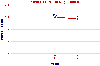
Corrie Classification and Statistics Settlement Type: village Population (1971): 143 (1961): 150 Tourist Rating: No Text of Entry Updated: 28-JUL-2012 Location Latitude: 55.6412°N Longitude: 5.1397°W National Grid Reference: NS 025 431 A range of modern and historical maps are accessible through the map tab on the right of this page Get directions by entering the UK postcode of your location, home or hotel here eg. EH1 3YT Use the tabs on the right of this page to see other parts of this entry Related Entries There are 11 related entries. (1 Attraction, 1 Council Area, 1 Historical County, 4 Features, 1 Parish, 0 People and 3 Settlements) Names that are not linked do not currently contain any information. Attractions: Arran Council Area: North Ayrshire Features: Am Binnein Cir Mhor Mullach Buidhe North Goatfell Historical Counties: Bute and Arran Parishes: Kilbride Settlements: Brodick High Corrie Lochranza
There are 11 related entries. (1 Attraction, 1 Council Area, 1 Historical County, 4 Features, 1 Parish, 0 People and 3 Settlements)
Names that are not linked do not currently contain any information.
By using our site you agree to accept cookies, which help us serve you better