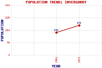
Invergarry Classification and Statistics Settlement Type: village Population (1971): 178 (1961): 136 Tourist Rating: N/A Text of Entry Updated: 08-JUN-2011 Location Latitude: 57.0697°N Longitude: 4.7925°W National Grid Reference: NH 308 011 A range of modern and historical maps are accessible through the map tab on the right of this page Get directions by entering the UK postcode of your location, home or hotel here eg. EH1 3YT Use the tabs on the right of this page to see other parts of this entry Related Entries There are 23 related entries. (4 Attractions, 1 Council Area, 1 Historical County, 12 Features, 1 Parish, 1 Person and 3 Settlements) Names that are not linked do not currently contain any information. Attractions: Daingean Trail Glengarry Heritage Centre Invergarry Castle Well of the Seven Heads, The Council Area: Highland Features: Bhainne, Loch a' Carn Dearg Garry, Glen Garry, Loch Garry, River Garry-Moriston Hydro-Electric Power Scheme Glas Bheinn Glengarry Castle Hotel Invergarry Power Station Lochaber Millennium Wind Farm Oich, Loch Historical Counties: Inverness-shire Parishes: Kilmonivaig People: Sir Daniel (Danny) Alexander Settlements: Inchlaggan Laggan Mandally
There are 23 related entries. (4 Attractions, 1 Council Area, 1 Historical County, 12 Features, 1 Parish, 1 Person and 3 Settlements)
Names that are not linked do not currently contain any information.
By using our site you agree to accept cookies, which help us serve you better