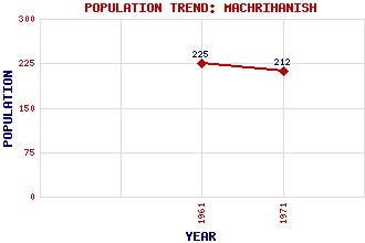
Machrihanish Classification and Statistics Settlement Type: village Population (1971): 212 (1961): 225 Tourist Rating: N/A Text of Entry Updated: 07-JUN-2007 Location Latitude: 55.4211°N Longitude: 5.7387°W National Grid Reference: NR 635 205 A range of modern and historical maps are accessible through the map tab on the right of this page Get directions by entering the UK postcode of your location, home or hotel here eg. EH1 3YT Use the tabs on the right of this page to see other parts of this entry Related Entries There are 21 related entries. (3 Attractions, 1 Council Area, 1 Historical County, 10 Features, 1 Parish, 1 Person and 4 Settlements) Names that are not linked do not currently contain any information. Attractions: Campbeltown Cross Kintyre Way Machrihanish Golf Course Council Area: Argyll and Bute Features: Breackerie Water Campbeltown Airport Cnoc Reamhar Cruach Mhor Wind Farm Earadale Point Kintyre Machrihanish Air Station Remuil Hill Slate, The Tangy Wind Farm Historical Counties: Argyllshire Parishes: Campbeltown People: Henry Edward Clifford(H.E. Clifford) Settlements: Ballygroggan Campbeltown Drumlemble Trodigal
There are 21 related entries. (3 Attractions, 1 Council Area, 1 Historical County, 10 Features, 1 Parish, 1 Person and 4 Settlements)
Names that are not linked do not currently contain any information.
By using our site you agree to accept cookies, which help us serve you better