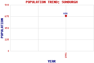
Sumburgh Classification and Statistics Settlement Type: settlement Population (1991): 686 Tourist Rating: Text of Entry Updated: 07-MAY-2013 Location Latitude: 59.8678°N Longitude: 1.2821°W National Grid Reference: HU 403 094 A range of modern and historical maps are accessible through the map tab on the right of this page Get directions by entering the UK postcode of your location, home or hotel here eg. EH1 3YT Use the tabs on the right of this page to see other parts of this entry Related Entries There are 24 related entries. (4 Attractions, 1 Council Area, 1 Historical County, 1 Family, 12 Features, 1 Parish, 1 Person and 3 Settlements) Names that are not linked do not currently contain any information. Attractions: Jarlshof Old Scatness Broch and Iron Age Village Scalloway Castle Sumburgh Head Lighthouse Council Area: Shetland Families: Bruce Features: Burgi, Ness of Dunrossness North Sea Northern Isles, The Scousburgh, Bay of Sheddocksley South Mainland Sumburgh Airport Sumburgh Head Sumburgh Hotel Swarta Skerry West Voe of Sumburgh Historical Counties: Shetland Parishes: Dunrossness People: Robert Stevenson Settlements: Lerwick Noss Scalloway
There are 24 related entries. (4 Attractions, 1 Council Area, 1 Historical County, 1 Family, 12 Features, 1 Parish, 1 Person and 3 Settlements)
Names that are not linked do not currently contain any information.
By using our site you agree to accept cookies, which help us serve you better