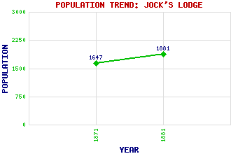
Jock's Lodge Classification and Statistics Settlement Type: locality Population (1881): 1881 (1871): 1647 Tourist Rating: N/A Text of Entry Updated: 22-APR-2019 Location Latitude: 55.9545°N Longitude: 3.1466°W National Grid Reference: NT 285 741 A range of modern and historical maps are accessible through the map tab on the right of this page Get directions by entering the UK postcode of your location, home or hotel here eg. EH1 3YT References and Further Reading Hamilton, Alan (1978) Essential Edinburgh. Andre Deutsch, London Use the tabs on the right of this page to see other parts of this entry Related Entries There are 15 related entries. (3 Attractions, 1 Council Area, 1 Historical County, 6 Features, 1 Parish, 0 People and 3 Settlements) Names that are not linked do not currently contain any information. Attractions: Holyrood Park Meadowbank Stadium St Margaret's Well Council Area: City of Edinburgh Features: Craigentinny Depot Lochend Meadowbank Parson's Green Piershill Willowbrae Historical Counties: Midlothian Parishes: Edinburgh Settlements: Edinburgh Portobello Restalrig
There are 15 related entries. (3 Attractions, 1 Council Area, 1 Historical County, 6 Features, 1 Parish, 0 People and 3 Settlements)
Names that are not linked do not currently contain any information.
By using our site you agree to accept cookies, which help us serve you better