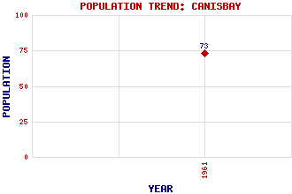
Canisbay Classification and Statistics Settlement Type: settlement Population (1961): 73 Tourist Rating: N/A Text of Entry Updated: 19-SEP-2003 Location Latitude: 58.6318°N Longitude: 3.1246°W National Grid Reference: ND 348 721 A range of modern and historical maps are accessible through the map tab on the right of this page Get directions by entering the UK postcode of your location, home or hotel here eg. EH1 3YT Use the tabs on the right of this page to see other parts of this entry Related Entries There are 15 related entries. (0 Attractions, 1 Council Area, 1 Historical County, 6 Features, 1 Parish, 0 People and 6 Settlements) Names that are not linked do not currently contain any information. Council Area: Highland Features: Caithness Duncansby Head Giar Hill Orkney Islands Pentland Firth Warth Hill Historical Counties: Caithness Parishes: Canisbay Settlements: Gills Huna John o' Groats Seater Upper Gills West Canisbay
There are 15 related entries. (0 Attractions, 1 Council Area, 1 Historical County, 6 Features, 1 Parish, 0 People and 6 Settlements)
Names that are not linked do not currently contain any information.
By using our site you agree to accept cookies, which help us serve you better