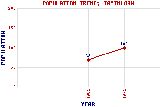
Tayinloan Classification and Statistics Settlement Type: village Population (1971): 100 (1961): 68 Tourist Rating: N/A Text of Entry Updated: 21-AUG-2012 Location Latitude: 55.6518°N Longitude: 5.6621°W National Grid Reference: NR 697 459 A range of modern and historical maps are accessible through the map tab on the right of this page Get directions by entering the UK postcode of your location, home or hotel here eg. EH1 3YT Use the tabs on the right of this page to see other parts of this entry Related Entries There are 17 related entries. (2 Attractions, 1 Council Area, 1 Historical County, 8 Features, 1 Parish, 0 People and 4 Settlements) Names that are not linked do not currently contain any information. Attractions: Gigha Kintyre Way Council Area: Argyll and Bute Features: Clachaig Water Cnoc Reamhar Cnoc nan Craobh Cruach Mhic-an t-Saoir Garasdale, Loch Kintyre Narachan Hill Rhunahaorine Point Historical Counties: Argyllshire Parishes: Killean and Kilchenzie Settlements: Ardminish Ballochroy Killean Rhunahaorine
There are 17 related entries. (2 Attractions, 1 Council Area, 1 Historical County, 8 Features, 1 Parish, 0 People and 4 Settlements)
Names that are not linked do not currently contain any information.
By using our site you agree to accept cookies, which help us serve you better