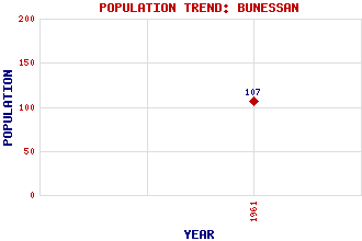
Bunessan Classification and Statistics Settlement Type: hamlet Population (1961): 107 Tourist Rating: N/A Text of Entry Updated: 26-OCT-2022 Location Latitude: 56.3161°N Longitude: 6.2352°W National Grid Reference: NM 382 218 A range of modern and historical maps are accessible through the map tab on the right of this page Get directions by entering the UK postcode of your location, home or hotel here eg. EH1 3YT Use the tabs on the right of this page to see other parts of this entry Related Entries There are 29 related entries. (3 Attractions, 1 Council Area, 1 Historical County, 13 Features, 1 Parish, 1 Person and 9 Settlements) Names that are not linked do not currently contain any information. Attractions: Iona Mull Ross of Mull Historical Centre Council Area: Argyll and Bute Features: Ardtun Assapol, Loch Ban, Eilean Bunessan River Caol, Loch Cruachan Min Lathaich, Loch na Mor, Eilean Pennyghael Ross of Mull Traigh na Eilean an t-Santachaidh Traigh na Margaidh Tuath, Camas Historical Counties: Argyllshire Parishes: Kilfinichen and Kilvickeon People: Mary MacDougal Macdonald Settlements: Ardchiavaig Ardtun Aridhglas Camas Fionnphort Lee Lower Ardtun Pennyghael Uisken
There are 29 related entries. (3 Attractions, 1 Council Area, 1 Historical County, 13 Features, 1 Parish, 1 Person and 9 Settlements)
Names that are not linked do not currently contain any information.
By using our site you agree to accept cookies, which help us serve you better