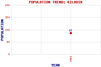
Kilmuir Classification and Statistics Settlement Type: settlement Population (1961): 87 Tourist Rating: Yes Text of Entry Updated: 16-APR-2005 Location Latitude: 57.6472°N Longitude: 6.3877°W National Grid Reference: NG 383 704 A range of modern and historical maps are accessible through the map tab on the right of this page Get directions by entering the UK postcode of your location, home or hotel here eg. EH1 3YT Use the tabs on the right of this page to see other parts of this entry Related Entries There are 11 related entries. (3 Attractions, 1 Council Area, 1 Historical County, 1 Family, 3 Features, 1 Parish, 1 Person and 0 Settlements) Names that are not linked do not currently contain any information. Attractions: Flora MacDonald Monument Skye Skye Museum of Island Life, The Council Area: Highland Families: MacArthur Features: Mor, Camas Ru Bornesketaig Trotternish Historical Counties: Inverness-shire Parishes: Kilmuir People: Flora MacDonald
There are 11 related entries. (3 Attractions, 1 Council Area, 1 Historical County, 1 Family, 3 Features, 1 Parish, 1 Person and 0 Settlements)
Names that are not linked do not currently contain any information.
By using our site you agree to accept cookies, which help us serve you better