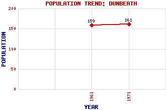
Dunbeath Classification and Statistics Settlement Type: village Population (1971): 161 (1961): 159 Tourist Rating: N/A Text of Entry Updated: 07-FEB-2012 Location Latitude: 58.2488°N Longitude: 3.4327°W National Grid Reference: ND 160 298 A range of modern and historical maps are accessible through the map tab on the right of this page Get directions by entering the UK postcode of your location, home or hotel here eg. EH1 3YT Use the tabs on the right of this page to see other parts of this entry Related Entries There are 24 related entries. (4 Attractions, 1 Council Area, 1 Historical County, 11 Features, 1 Parish, 2 People and 4 Settlements) Names that are not linked do not currently contain any information. Attractions: Clan Gunn Heritage Centre and Museum Dunbeath Heritage Centre Laidhay Croft Museum North Coast 500 Council Area: Highland Features: Achinavish Hill Beatrice Wind Farm Braemore Lodge Buolfruich Wind Farm Caithness Dunbeath Bay Dunbeath Castle Dunbeath Water Eagle's Rock Inver Maiden Pap Historical Counties: Caithness Parishes: Latheron People: Neil Gunn Thomas Telford Settlements: Borgue Newport Ramscraigs Wick
There are 24 related entries. (4 Attractions, 1 Council Area, 1 Historical County, 11 Features, 1 Parish, 2 People and 4 Settlements)
Names that are not linked do not currently contain any information.
By using our site you agree to accept cookies, which help us serve you better