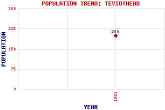
Teviothead Classification and Statistics Settlement Type: village Population (1991): 200 Tourist Rating: N/A Text of Entry Updated: 04-FEB-2007 Location Latitude: 55.3381°N Longitude: 2.9395°W National Grid Reference: NT 405 053 A range of modern and historical maps are accessible through the map tab on the right of this page Get directions by entering the UK postcode of your location, home or hotel here eg. EH1 3YT Use the tabs on the right of this page to see other parts of this entry Related Entries There are 51 related entries. (0 Attractions, 1 Council Area, 1 Historical County, 42 Features, 1 Parish, 2 People and 4 Settlements) Names that are not linked do not currently contain any information. Council Area: Scottish Borders Features: A7 Trunk Road Binks Hill Blackcleuch Rig Byehass Fell Calfshaw Head Cauldcleuch Head Comb Hill Dan's Hags Dod Hill Ewelair Hill Firestane Edge Frodaw Height Goat Hill Greatmoor Hill Harwood Rig Hawk Hill Hazelhope Hill Henry Scott Riddell Monument Henry Scott Riddell Monument Ladder Law Laird's Hill Lightning Hill Meg's Hill Merry Naze Mid Rig Muckle Land Knowe Pike Hill Pikethaw Hill Rashy Hill Redcleuch Edge Rowantree Hill Skelfhill Fell Southdean Rig Staney Hill Starcleuch Edge Swire Knowe Tanlaw Naze Teviot, River Teviotdale Tudhope Hill Wether Law White Hill Historical Counties: Roxburghshire Parishes: Teviothead People: Steven (Steve) Hislop Rev. Henry Scott Riddell Settlements: Caerlanrig Colterscleuch Edinburgh Hawick
There are 51 related entries. (0 Attractions, 1 Council Area, 1 Historical County, 42 Features, 1 Parish, 2 People and 4 Settlements)
Names that are not linked do not currently contain any information.
By using our site you agree to accept cookies, which help us serve you better